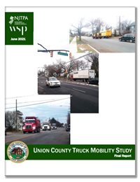
 Union County is a center for freight activity in New Jersey, home to part of the East Coast’s largest port and one of the busiest cargo airports in the country.
The volume of freight activity generates substantial truck traffic on Union County roads. The County launched the year-long Truck Mobility Study, in partnership with the NJTPA, to better understand how and where trucks are travelling; identify barriers to efficient and safe regional freight movement; and to recommend potential strategies to address those barriers.
The study aims to support and improve truck circulation, which is a critical part of residents’ lives. Trucks carry goods to businesses, deliver items purchased online directly to residents, and keep grocery stores stocked.
The study analyzed 174 miles of County roads and developed concepts for improving 10 locations, which the County will consider for implementation. The analysis considered vehicle, pedestrian and bicycle crash locations; existing conditions; freight generators; land use; and traffic data, among other factors. An initial list of 33 sites was selected based on this analysis. The final 10 sites were selected with input from a Technical Advisory Committee comprised of key stakeholders, focus groups, public outreach and county planning and engineering staff.
The concepts developed for each site are intended to serve as model that could be applied to other locations. The sites are:
| Street |
Cross Street |
Municipality |
Crash Hotspot |
Truck Generators |
Connector Route |
High Volume |
Point of Interest |
| Summit Ave (CR 657) |
Broad St (CR 512) to Springfield Ave |
Summit |
Truck/
BikePed |
Y |
NJ 24 |
N |
|
| Springfield Ave (CR 512) |
Passaic St (CR 647) to Academy St |
New Providence |
Truck |
Y |
NJ 24 |
N |
New Providence High School |
| New Providence Road |
Park ave (CR 655)/Bonnie Blum Rd (CR 641) |
Scotch Plains |
Truck |
Y |
I-78/US 22 |
N |
Weldon Concrete/
School |
| Vauxhaull road (CR 630) |
Liberty Ave |
Union Township |
Truck |
Y |
I-78/US 22 |
Y |
Jefferson Elementary School |
| Vauxhaull road (CR 630) |
Stuyvesant Ave (CR 619) |
Union Township |
Truck/
BikePed |
Y |
I-78/US 22/NJ 82/NJ 28 |
N |
|
| South Ave (CR 610) |
Centennial Ave (CR 619) |
Cranford |
Truck |
N |
US 1&9/NJ 28 |
Y |
Lincoln School |
| 1st Ave (CR 610) |
Locust St (CR 619) |
Roselle |
Truck/
BikePed |
N |
US 22/NJ 28/NJ 27 |
Y |
|
| Elizabeth Ave (CR 510) |
Scott ave (CR 650) to N. Stiles St (CR 615) |
Linden |
Truck |
Y |
CR parallel to US 1&9/NJ 27 |
Y |
Former GM Plant |
| Elizabeth Ave (CR 510) |
Wood Ave (CR 617) |
Linden |
Truck/
BikePed |
Y |
US 1&9/NJ 27/NJ 28/US 22 |
Y |
Linden Train Station |
| Wood Ave (CR 617) |
Linden Ave |
Linden |
Truck/
BikePed |
Y |
US 1&9/NJ 27/NJ 28/US 22 |
Y |
Linden Train Station |
Potential improvements include increasing capacity, improving signage and wayfinding, signal upgrades, limiting trucks on specific routes or providing alternate routes, increasing bridge clearances, and pedestrian or bicycle safety improvements.
The County plans to prioritize the projects and work with municipalities and the New Jersey Department of Transportation to implement the study’s recommendations.
Recommendations for each road are available in the
Final Report.
This study was completed through the NJTPA’s Subregional Studies Program, which provides two-year grants on a competitive annual basis to the 13 counties and two cities — known as subregions — represented on the NJTPA Board.
The program aims to help subregions develop recommendations for transportation improvements consistent with the NJTPA’s Long Range Transportation Plan.