September 2023
Posted: 9/27/2023 9:39:57 AM
Trucks carried more than 90 percent of the domestic freight that travels through Hudson County in 2020, a level that’s expected to continue through 2050. While that can be a boon for employment and jobs, it can also present challenges when it comes to traffic, congestion and safety.
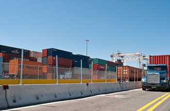 The Hudson County Truck Routes Assessment, funded through the NJTPA’s Subregional Studies Program, aimed to establish a comprehensive understanding of trucking’s impact on the infrastructure, economy and communities while also making recommendations to help trucks move more efficiently and reduce negative impacts on residents.
"A coordinated, long-term, strategic truck movement plan helps prioritize projects and ensure resources are used efficiently,” the study noted. “A combination of policies, regulations, infrastructure improvements, and enforcement aid in improving efficiencies, sustainability, and reducing impacts.”
Recommendations in the recently completed 331-page study ranged from the seemingly simple, such as designating curbside loading zones, adding signage and boosting enforcement on residential streets, to more innovative, like designating flexible shared space to serve as loading/unloading during peak commercial hours and general parking at other times, to encouraging the use of new technologies like e-cargo bikes to reduce truck deliveries.
The recommendations are organized by commercial, industrial, and residential.
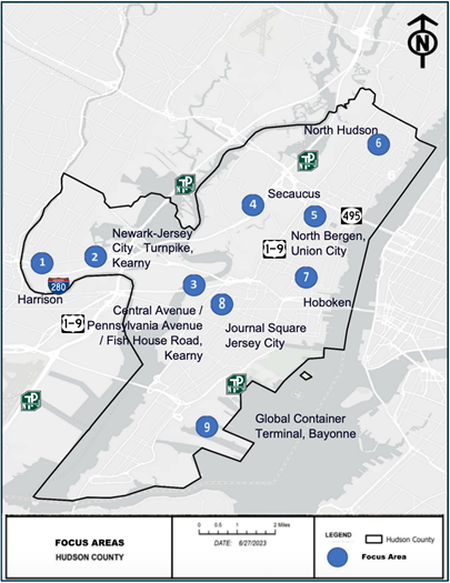 The study also developed truck circulation and safety recommendations for nine geographic focus areas that were identified through stakeholder and public input as having significant truck traffic:
- Harrison
- Harrison Avenue and Newark-Jersey City Turnpike (Harrison and Kearny)
- Fish House Road/Pennsylvania Avenue/Central Avenue (Kearny)
- Secaucus
- North Bergen and Union City
- North Hudson (consisting of West Side Avenue, US Route 1&9/Tonnelle Avenue, JFK Boulevard, and Bergenline Avenue)
- Hoboken
- Journal Square (Jersey City)
- Global Container Terminal (Bayonne)
The study acknowledges that many of the recommendations will require coordination with municipalities while some may not be applicable or desired in certain communities.
Although crashes involving trucks represent a small proportion of total crashes within the County, specific areas see high frequencies of crashes, in particular sideswipe crashes, according to the study.
Enforcement and signage can help to keep large trucks off local roads and on more appropriate larger regional roadways, according to the study. Heavy trucks generally remain on the large truck network, however, medium-sized trucks use roads throughout the county for local deliveries. Medium trucks are defined as Gross Vehicle Weight (GVW) of 7 to 13 tons and heavy trucks are those with GVW of more than 13 tons.
While the demand for goods continues to increase, the available space for roadways and infrastructure is static,” the study notes. “To meet the needs of goods movement, the efficiency of existing facilities and infrastructure must be increased while improving safety and preventing harm to our communities and residents – something that can only be achieved through strategic planning, design, policy, and investment to enhance the current system without disruption.”
The final report is available here.
Posted: 9/26/2023 12:34:11 PM
A new transportation plan for Essex County recommends a variety of policies, strategies, and studies as diverse as the county itself, such as, updating Complete Streets policies and plans; conducting corridor studies and traffic studies; and implementing Roadway Safety Audit and School Travel Plan improvements, among others.
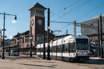 Essex 2045, funded through the NJTPA’s Subregional Studies Program, updates the county’s previous Comprehensive Transportation Plan, completed in 2013. The effort included extensive community outreach and technical analysis to develop a plan for future infrastructure investments. “Essex 2045 seeks to balance the often conflicting needs of safety, equity, mobility, traffic congestion, commerce, job creation, and sustainability to achieve equitable outcomes and access to opportunity though a comprehensive program of strategies, plans, and projects,” the plan explains.
The plan forecasts future needs, including an estimated 25,000 electric vehicle charging stations across the county by 2045. That's 100 times more than the 250 existing ports.
Several recommendations relate directly to Complete Streets and Vision Zero, such as:
- Updating the county’s Complete Streets Policy and getting all 21 municipalities to adopt it;
- Adopting the Safe System Approach - which aims to build layers of protection to prevent crashes in the first place and minimize harm when they occur - as the guiding framework for transportation planning and infrastructure design;
- Initiating a Vision Zero Action Plan for the county or targeted municipalities with “significant equity concerns and disproportionate safety risks.”
More than 1,000 people provided feedback through public engagement efforts. Comments covered a variety of topics, including the safety and adequacy of pedestrian and bicycle infrastructure, and the need for expanded intracounty transit service — especially in underserved communities.
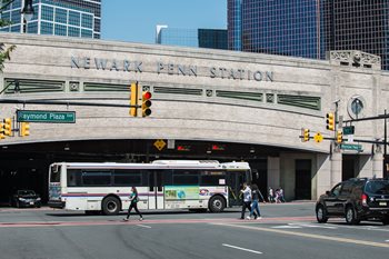
The plan also prioritizes the
Essex-Hudson Greenway, a 9-mile connector between Jersey City and Montclair; the
Morris Canal Greenway, a multiuser trail spanning six counties, including Essex; and, the Newark Industrial Track corridor for potential bus rapid transit or light rail between Paterson and Newark,
which was the focus of a previous subregional study in 2020. “Developing a new Paterson-Newark rail alignment is responsive to the many comments received during the Essex 2045 community engagement effort expressing a strong interest in the expansion of intra-county public transit service,” Essex 2045 notes.
A scenario planning process examined how travel conditions and congestion might change over time as the population grows and new jobs are created. Three scenarios — existing year 2022, future baseline 2045, and future aspirational 2045 — were tested for Essex 2045, which found that an alternative mix of projects has the potential to achieve the “aspirational” goals, including improved safety, accessibility, and equity, expansion of intra-county transit and travel mode options, congestion relief, and mitigating truck impacts.
The plan recommends additional countywide studies of bicycle, pedestrian and micromobility; freight and goods movement; and roadway drainage and flooding.
The
final report is available here.
Posted: 9/18/2023 11:37:03 AM
For the first time in the 100-year history of the world’s busiest bridge, pedestrians and cyclists can connect from sidewalks on the New York and New Jersey sides of the Hudson River directly to the George Washington Bridge. Bicyclists no longer have to carry their bikes up stairs but instead can enjoy plazas and viewing platforms on either end, protected by bollards and pylons.
The changes are part of pedestrian and cyclist access improvements, which Alexander Levi, a principal architect in the Design Division of the Engineering Department at the Port Authority of New York and New Jersey, outlined in a presentation to the NJTPA Board of Trustees during its September 12 meeting.
Jay Shuffield, who represents the Port Authority on the NJTPA Board, said the bridge is a significant goods movement corridor, but it’s also the only direct Hudson River crossing for pedestrians and cyclists. The $2 billion to rehabilitate the bridge is funded entirely by Port Authority revenue, as toll roads are ineligible for federal funding, he said.
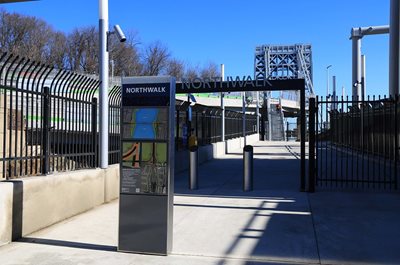 Levi said the bridge has never had an accessible way for people on bike or foot to cross the span. Othmar Ammann, the original engineer, designed a sidewalk that went from anchorage to anchorage but did not connect back on both sides to the respective approaches. The bicycle and pedestrian improvements are part of a larger rehabilitation project called Restore the George.
“The multi-year effort to ‘Restore the George’ gave us the opportunity to not only replace the suspender ropes, check the main cables, and do a whole bunch of upgrades, but finally consider accessibility across the bridge for people making their way across without a car,” Levi said. Photo Credits: Port Authority NY NJ
Work on the North Walk began in 2017 and was recently completed. Long switchback ramps 11 to 14 feet wide were installed to provide access, eliminating the need for cyclists to navigate stairs and hairpin turns. The New Jersey ramp connects to the Long Path in Palisades Interstate Park in Fort Lee and there is also a viewing area.
The North Walk opened in February and has seen “incredible volume” even during the week. “It’s not just a leisure bridge, it’s become more than ever a commuting connection between the two sides,” Levi said.
The southern side of the bridge is now closed to pedestrians and cyclists. The new South Walk is expected to open in 2027. Once both sides are complete, there are plans for the North Walk to be used exclusively by cyclists and for the South Walk to be for pedestrians and people in wheelchairs, Levi said.
In addition to the new access ramps, platforms were built around the bridge towers to eliminate successive 90-degree turns and instead allow for more visual distance. “There’s a suggestion of a shared use environment and approach,” he said. “You see other people coming and you respect and monitor the distance as you head toward them.”
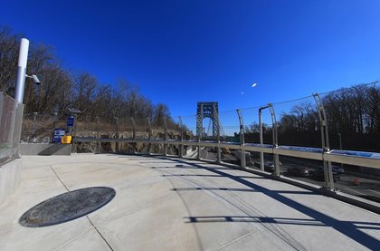 Specifically on the Fort Lee side, the project integrated an entire upgrade of the biking infrastructure along Hudson Terrace, including a bidirectional bike path and intersection upgrades to improve safety for pedestrians and cyclists. “For the first time in my memory as a cyclist, you can come down from your 50- to 100-mile ride and actually cross safely onto the bike path, with an actual light that is made for your turn onto this plaza,” Levi said.
Previously, there was no space for cyclists to meet as they waited to travel north along the Palisades, so they gathered dangerously along the streets. Now, there is an entry plaza on both the New York and New Jersey side, with bollards and pylons and a gate for a sense of placemaking.
The NJTPA also is coordinating with the New York Metropolitan Transportation Council on a feasibility study of a separated walking-biking path along the Palisades Interstate Parkway and U.S. 9W corridor connecting the George Washington Bridge to the Governor Mario M. Cuomo Bridge, formerly the Tappan Zee Bridge, which also has upgraded walking and biking facilities.
Levi described it as an unprecedented moment in the GWB’s history to “connect its original sidewalks to its respective communities that it serves.”
He noted that the project also includes an educational component. “You also get to celebrate and understand and learn about the bridge in a way that you hadn’t before, with interpretive displays and places to rest and look at the towers.”
Posted: 9/14/2023 9:31:49 AM
The need for flexible travel services, centralized information, improved driver training, and safe and convenient access to destinations are among the greatest transportation needs identified for disadvantaged populations in the NJTPA region.
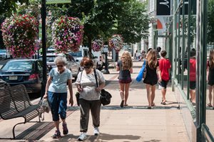 NJTPA staff recently worked with service providers, community representatives and partner agencies to update the Coordinated Human Services Transportation Plan (CHSTP) for the 13-county region. The goal of the update was to prioritize the needs and strategies identified in Go Farther, the CHSTP adopted in 2017. Go Farther was prepared with consultant support from the Alan M. Voorhees Transportation Center at Rutgers University and data collection and public outreach support from the state’s eight Transportation Management Associations (TMAs). It identified the transportation needs of older adults (those 65 and older), low-income people, veterans, and individuals with disabilities and provides strategies for meeting those needs and prioritizing transportation services for funding and implementation.
The update includes new demographic data, findings from a stakeholder survey and focus group, and re-prioritized recommendations to better address the transportation needs of these populations.
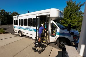 The region’s TMAs, along with non-profits and local governments, are important implementers of this plan. NJTPA Executive Director David Behrend noted the TMAs have travel training programs that help older adults, those with disabilities, and others better understand and use transit services in their areas. “It’s an innovative and worthy program, and a good example of the kind of work encouraged by this plan,” he said at the NJTPA’s September 12 Board of Trustees meeting.
The more recent survey results indicated several needs that were more relevant than in 2017, including driver training, performance, and retention; fare subsidies; flexible service; and accessibility.
In addition to reduced fares for older adults and people with disabilities, the update identified other prioritized strategies such as partnering with Transportation Network Companies (TNC), and expanding and replicating existing non-profit care services with paid or volunteer drivers and existing cab subsidy programs.
The four target populations comprise 40 percent of the overall population of the NJTPA region:
- 40 percent, people 65 and older
- 11 percent, low-income population
- 10 percent, people with disabilities
- 3 percent, veterans
While it is difficult to forecast veteran populations in the future, other target populations are expected to grow by double digits by 2050:
- +22 percent, people 65 and older
- +14 percent, low-income population
- +11 percent, people with disabilities
Ocean County ranks highest or very high for all four target populations. It has the highest proportion of people with disabilities and also the most significant number of veterans, substantially larger than other counties. Essex County has the largest number of people with disabilities and along with Hudson, Passaic and Union Counties, ranks very high for low-income populations. Bergen County ranks high for the 65+ population.